
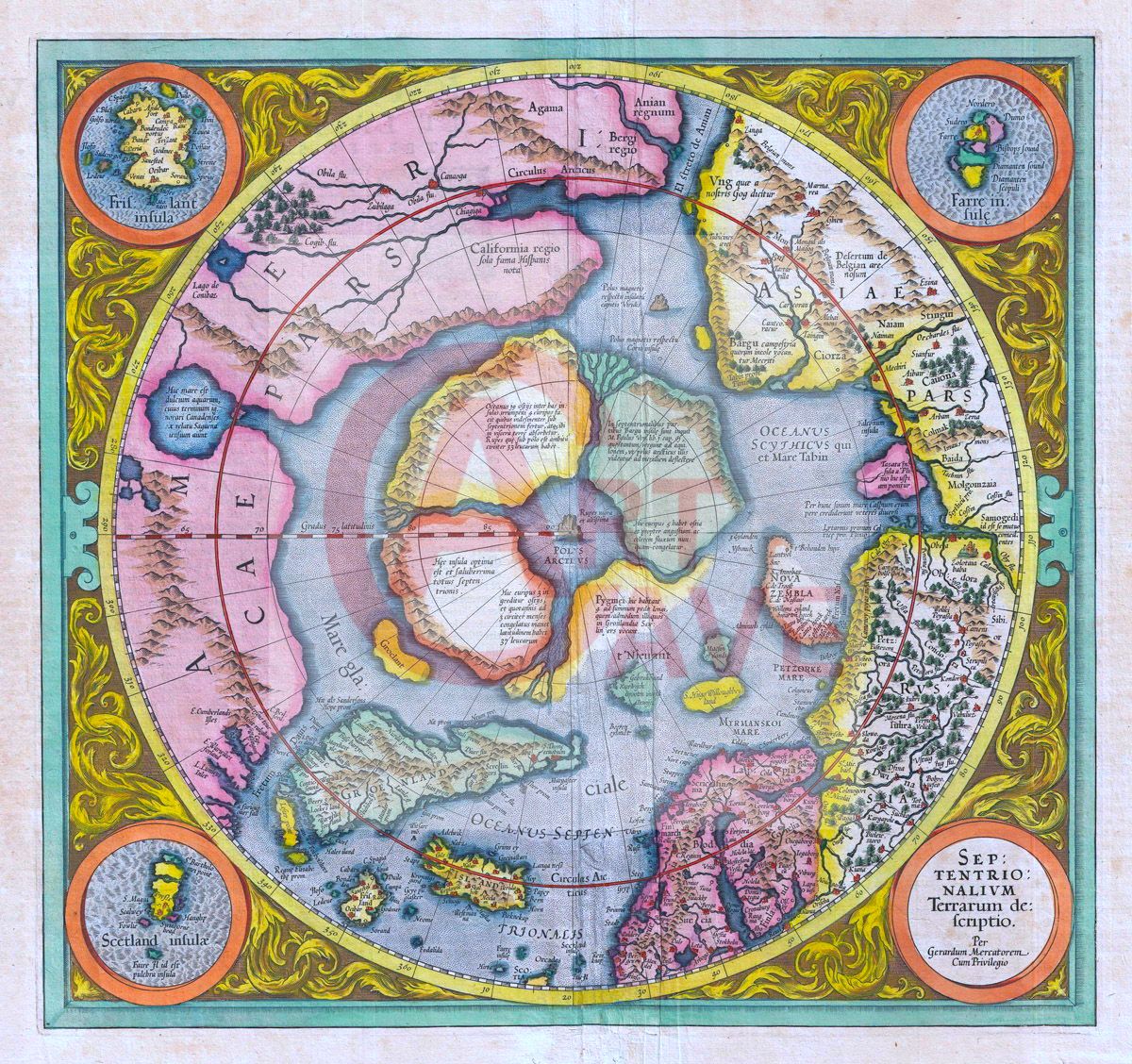
The First Map of the North Pole Digital Print
Artist: Gerard Mercator and Hondius Jodocus
Title: The First Map of the North Pole
Year: 1606
Movement(s): Cartography
Your digital print download will be emailed to you upon completion of purchase. It has been processed to print at 300 dpi and will arrive without a watermark. Your high-quality, digital print has been processed and restored to print beautifully.
Original file size in pixels: 1200 x 1100 pixels

Reviews
There are no reviews yet.